Cities Without Maps is an artistic mapping project for a Kampung along the Code River (pronounced cho-day), Yogyakarta, Indonesia. This is an area which has hitherto existed without a map based on any Cartisan principles of perspective and scale. Beginning the process of making a map – for a place which exists relatively happily without one -presented us with the challenge of reinventing what a map is. Do we just map the geographic space or do we map other social aspects which constitute this physical space? For example, how does a map reflect issues such as how many people live in each house or how space is used differently by men and women, older or younger people? What purpose does a map represent for a community who has shaky legal ownership ofthe land they live on, and who navigate between houses based on long term memory of which families have lived there? How do we map things like the numerous ghost stories which collect in a community built on a former Chinese grave-yard and provide traces of the lives of past residents? How do we include the numerous social maps inked directly onto the body through the strong tattoo culture in Kali Code?
This project is a mapping of the community, in collaboration with some of its members, where we view space as a combination of both its physical and social aspects. We decided that a map is not just a two dimensional object but a more complex representation of the various connections which make up a specific location. This project has been generated out of drawing and mapping workshops and discussions in the local area and video documentation of interviews with community members about their relationship to the area.
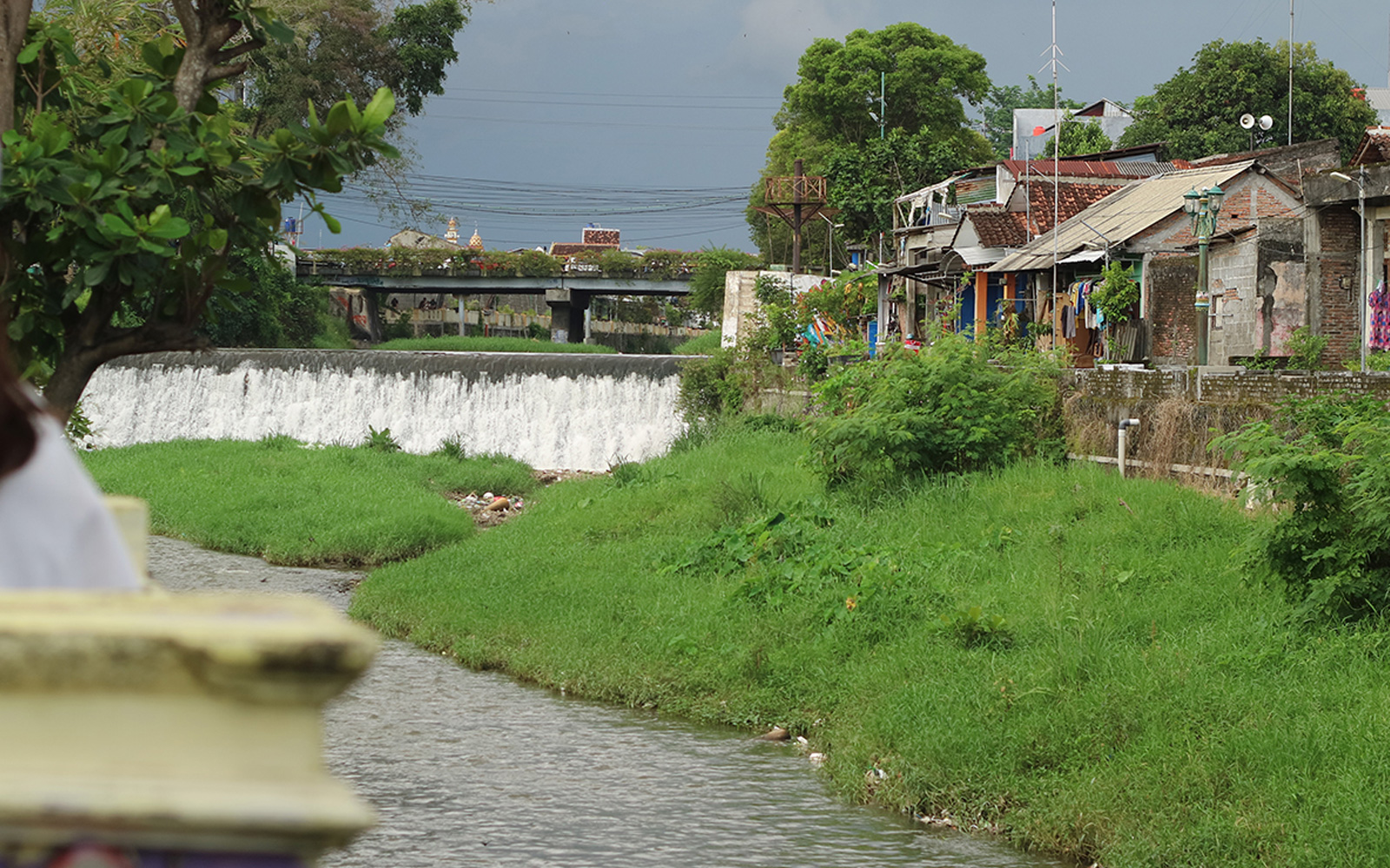
Kali Code is a unique and contradictory place: it exists as a semi-squatter community but its houses are relatively well established and not always under threat of immediate eviction; its community has greater freedom over the construction and design of their own immediate living space but are also subject to government repression, corruption and neglect. While most houses are self designed and constructed several blocks of apartments have also been built along the river by developers and some residents live within these more regulated living spaces. During this mapping project building was underway for a new block of apartments and several houses in the squatter community were marked for demolition.
Kali Code is home to poor people and also those who choose this place so that they can live without society judging them for personal choices over sexuality, marital status or other indicators of dissent such as tattoos. It is a somewhat permissive space relatively autonomous from other more formal city where young people come to nongkrong (hang out) and set up houses together. But Kali Code is also a densely packed and highly communal (self) regulated space with a porous boundary between public and private life and many obligations for community participation and responsibility.
Part of our inspiration in this project is Mike Davis’s book Planet of Slums which explores how the majority of people in the world live outside formal economic and government structures. While these “slums” have many social problems and exist in states of genuine poverty they can also generate important examples of community based architecture, social planning and autonomy. These aspects link into our ongoing interest in researching the structures of urban communities and the “free”, “public” or “communal” spaces people continuously create within them.
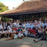
As part of our Asialink/Indonesian Visual Arts Archive (IVAA) residency in Yogyakarta we are producing a mapping project of Kali Code with Vanie (a local activist from the area). The mapping project is comprised of a film, a publication and a film screening from a Warung Cinema on Kali Code. The Warung Cinema will also travel to other places in the world for further exhibitions. The maps have been generated through workshops (such as a drawing workshop with local kids), discussions, film interviews, our own drawings and other forms of observation.
Cities Without Maps grows out of the 2016: Archive Project which is a ten year artistic mapping of the suburb of Redfern which we began in 2006. 2016 is both the postcode for Redfern and the scheduled date for completion of the project. Redfern is an inner city suburb of Sydney which has traditionally been home to strong and numerous working class, Indigenous, migrant and student communities but which is also under going a rapid process of gentrification. From this interest in our local community has grown an interest in urbanism more broadly and the autonomous spaces communities can create within existing city structures.
This mapping project challenges the notion of the “monolithic metropolis” by looking at the various gaps and striated spaces that exist within city life and the ways in which these spaces will always conflict with attempts at spatial homogenization and/or gentrification.
Zanny Begg & Keg de Souza